One beautiful sunny afternoon, Natalie and I loaded up the Bridge Mobile and headed out to Brattleboro. What a treat!

First stop, The Williamsville. The people of Brattleboro take their bridge reconstruction pretty seriously. There was a large sign explaining their efforts.

The residents also like their history! Nothing like a little history between friends.

This is an important sign, because there was A LOT of oncoming traffic in our short stint at the bridge.

What a beautiful job with the reconstruction!

We have seen very few actual speed limit signs on bridges. Most just say you can not go faster than a trot. I guess, a trot is 4 MPH.

You can see the rocks of the Rock River under the bridge.

We were pretty sure this was an ambulance coming through the bridge. Then we realized it was not. This picture also shows the beautiful reconstruction on the truss.

Artistic shot of the Rock River.

Lovin' the lattice!

The people of Brattleboro were very friendly. Shortly after this picture was taken a man stopped to tell me I had left my headlights on. Good thing this blogger has AAA(best Christmas present, ever)! Not to worry, it was a short trip on this bridge so my battery was strong.

Another fun tidbit from this bridge is that Natalie was taking the infamous Ellen bridge pose picture. As this was happening a truck sped up behind her. I did my civic duty and screamed, "You are going to die." Natalie ever committed to the blog still took the shot. The man stopped at the stop sign. And then suggested that "you should take another one." Natalie says this bridge pose shows the terror I felt. Wait until that one is posted :)

Natalie peers out of the window on the Williamsville. Such an exciting start to this adventure!
The next bridge we actually passed on our way to the Williamsville, but we showed restraint and followed the plan.

Presenting the West Dummerston.

We started off under the bridge.

Structure wise, it reminded me a lot of the Smith Millennium in Rumney. Don't worry, we did not leave the steps. The water was too fast to go wading.

Such a regal looking bridge.

These were the steep uneven stairs to the water. Watch your step!

The West Dummerston was built in 1872. The sign above the bridge proudly reminds people of that.
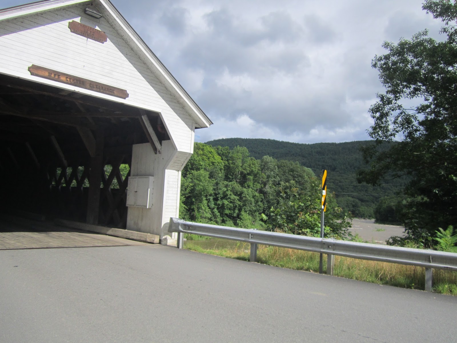
This bridge also was heavily travelled by cars. Brattleborro loves their bridges!

This is the West River.

I enjoyed the criss crossing of this support system.

Such a blue sky over the West Dummerston.

This makes it look like the bridge goes on forever. It doesn't. I checked.

This is a two page love letter written and laminated by Jack. It starts off, "Love is like a covered bridge..."

This is page 2. Hopefully things worked out well for Jack and BeccaBoo. This is more dramatic than the rose ceremony on the Bachelorette.
Next stop...The Creamery.


The Creamery Bridge, not the milk producer.

This was a charming bridge located on Route 9.

There were lots of weird bridge bugs...or possibly milk bugs.

This is the Whetstone Brook.

This is Natalie on a rock, not on the Whetstone.

This is one of the best finds on a bridge, yet. There was a certain blogger who really wanted to plug them in. I will give you one hint, her name rhymes with Batalie.

Another well labelled bridge.

We found this in the town square. Based on previous bridge experience, I am fearful that it might be a buried moose.

Hmmm. Has anyone seen Natalie? The electricity bill in Brattleboro might be a little higher this month.

The Creamery is no longer in use. This is a picture of the current bridge.

Katie loves bridges too.

Hey Boo Boo! How about a pic-a-nic? The Creamery would be a great place for it.

Oh Creamery, how cute you are!

Next bridge, the Green River.

Here you can see the Green River Dam.

The tall Green River located in Guilford.

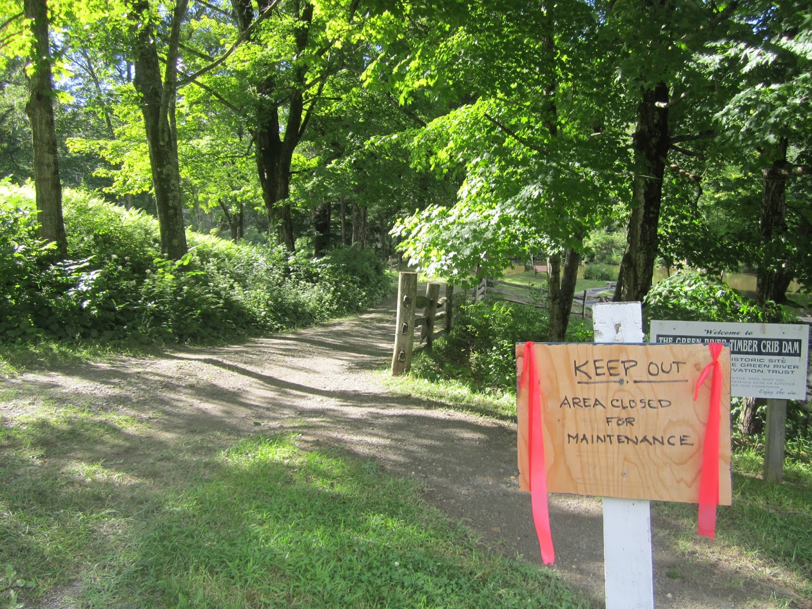
There is a town meeting related to the restoration project. We missed it.

The Historical Society for the Protection of Covered Bridges was here.

And apparently they don't read signs.

This was a tough rule to follow.

I guess we will have to park elsewhere.

Here is the Green River Bridge.

This signed kept us from getting a better view of the bridge.
It was such a pretty park area. What you can't see is that there was also a backhoe on the other side of the road. They mean business.

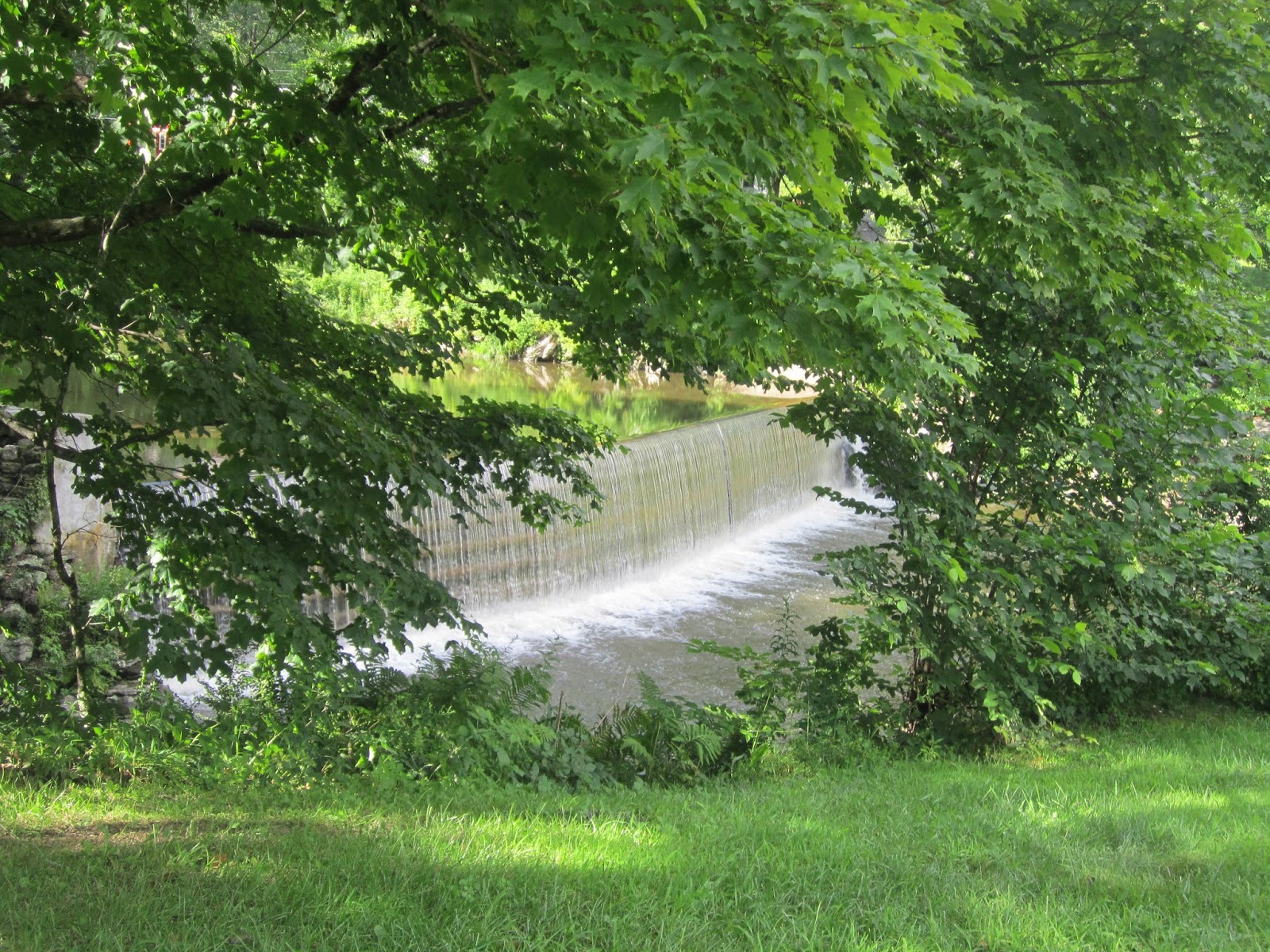
Dam! Another great view!
Normally Natalie navigates us easily around the Green Mountain state. Once in a while we come across a series of unmarked roads or directions that miss a couples steps. So we plug in the GPS. The journey to the next bridge was a bit long. First we ended up on a series of dirt roads. The GPS, said it knew where we were. Then it told us to reach route 9 by following a road. The road ended in someone's driveway, that kindly urged us to not trespass. So we turned around. Again our friendly GPS said it knew where we were. Then it told us to turn down this road. Here is that road:
That's funny, I don't see the road either. After turning around a few more times we made it back to route 9, no thanks to the GPS. We were also getting hungry. Oddly enough, there wasn't a place to get food on any of the dirt roads.
Eventually, we pulled up to the Marlboro School. I saw this:

I was thinking, this covered walkway doesn't count as a covered bridge.
Then on the playground, I saw this:

Again, I thought I hope that isn't the covered bridge.

Then I saw this. It is the ADORABLE Johnny Esau bridge! Totally worth the adventure getting here. Johnny Esau built this bridge in 2004 with his 4th grade class. The teachers of Vermont celebrate a love of covered bridges with their students!

There was also a totem pole next to the bridge.

There was also a map that showed the biking and walking trails in the area.

The students labelled the parts of the bridge.

Brace yourself, there is more bridge fun coming!

The sun shines on the Johnny Esau!

The names of the students who built the bridge.

My research also suggests that this bridge was inspired by the Silk Road Bridge in Bennington (yes, we have been there!).

Well done, Marlboro School! You have a nice bridge!
Next we found the well hidden bridge, The High Mowing Bridge.

It is located in a field in Wilmington. It is also surrounded by high grass. We have decided we may have to invest in gaiters to best view bridges with high grass. Perhaps, a better name would be the High Grassing Bridge.

A view from the left.

The view from the right.
At this point, we voted to call it a day. We were hungry and running out of daylight, so we headed home. That was the responsible thing to do!