We started our trek with a familiar bridge, The Cornish-Windsor. Those of you who followed in the past will remember that we ran through the bridge on foot, but it had the potential to be pretty dangerous. We quickly visited and said hello to our old friend as we continued on our path of VT!

Next it was on to the Martin's Mill Bridge. This is a simple bridge that spans the Lull Brook.

The Martin's Mill Bridge is nestled in a valley below Interstate 91.

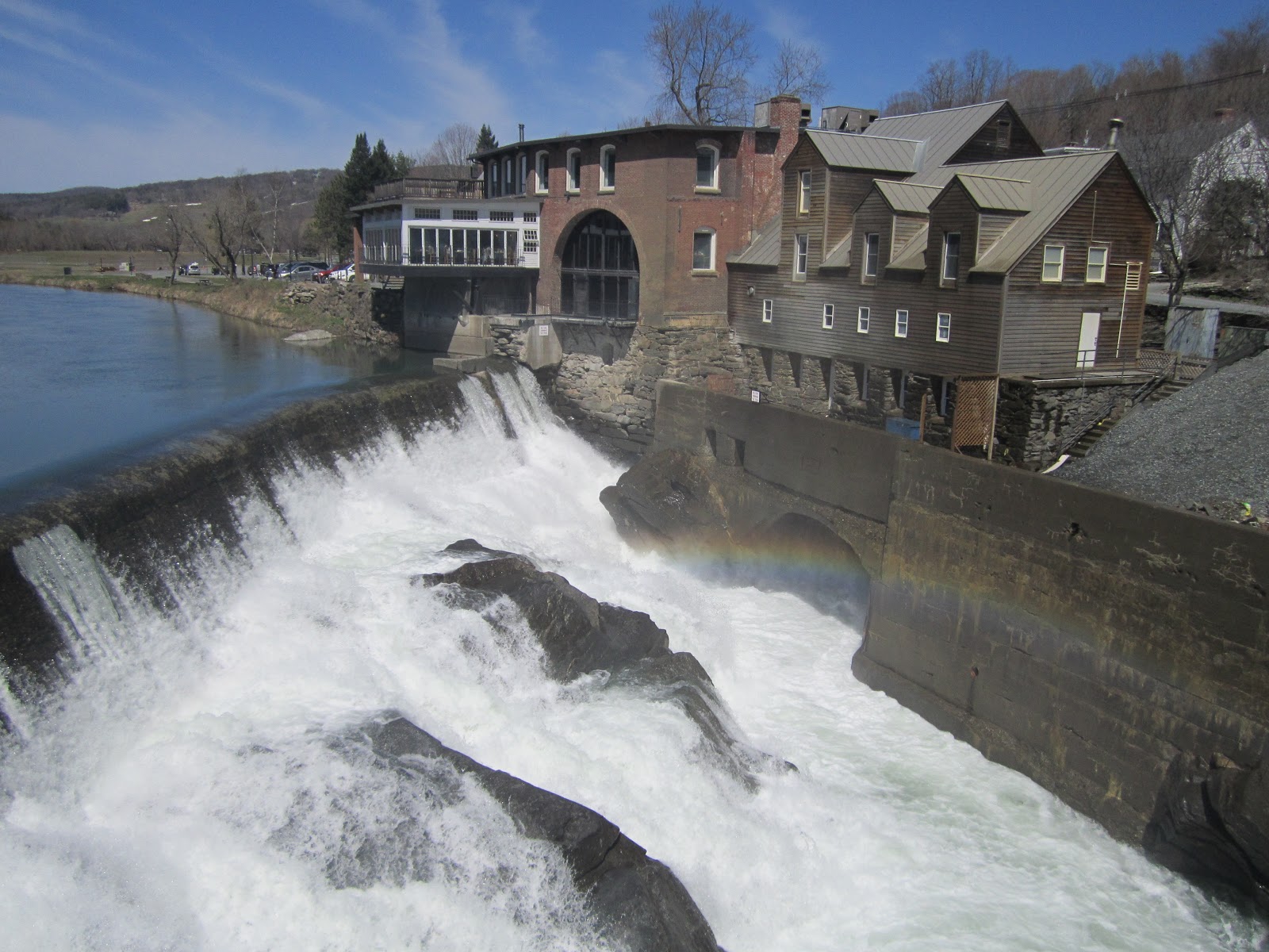
M.C. Escher would be proud of the tessellations we found on this former mill.
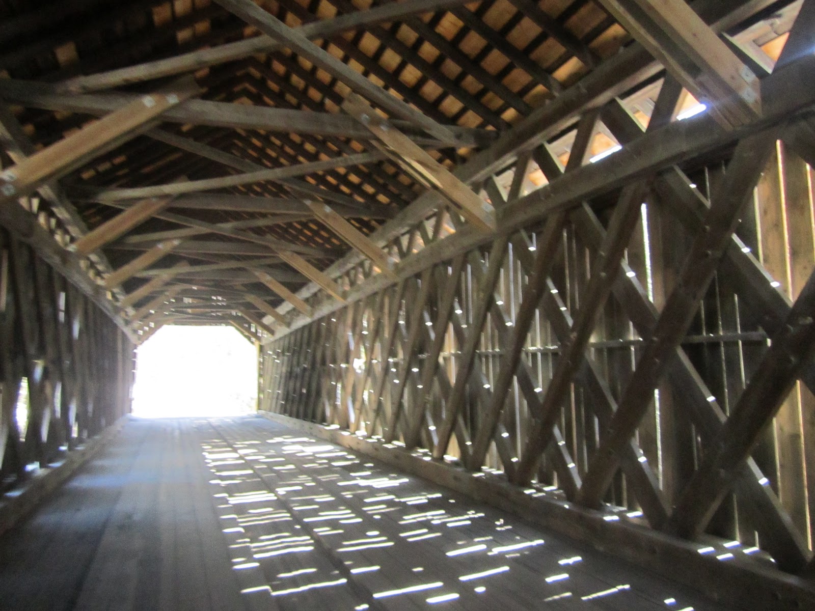
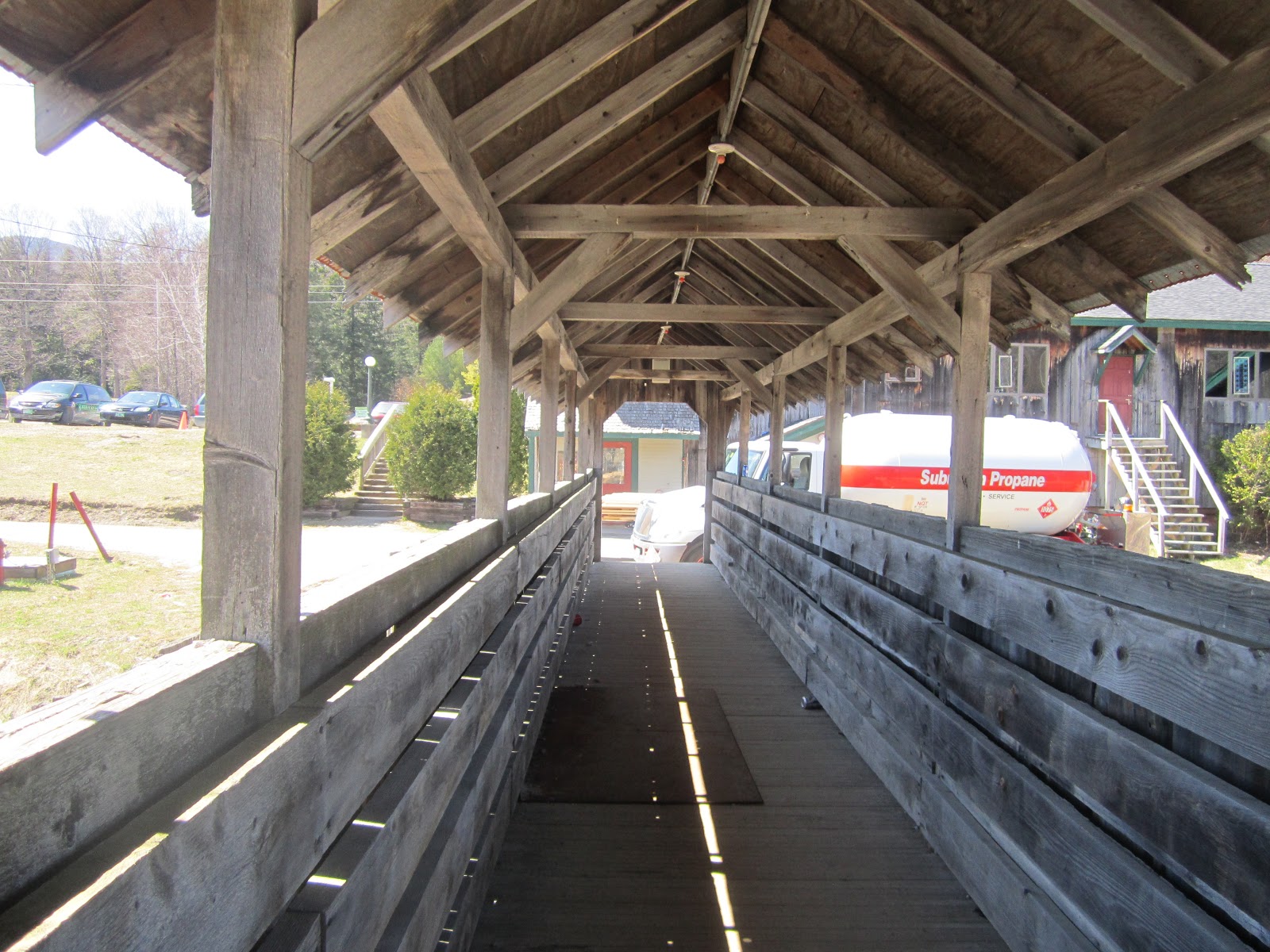
The overwhelming beauty of the covered bridge!

A room with a view!

Bridge, woods, and water...what's not to love?!?!

A view of the Lulls Brook, through one of the missing slats of the bridge.

This was a shelter near by the bridge. The locals have decorated it with a variety of lovely words and phrases. Parental guidance suggested...
We knew when from our directions that the Willard Bridge West and the Willard Bridge East were very close together. We didn't realize just how close until we were right there!

We could practically spit on one bridge to the other...of course we wouldn't have disrespected a bridge like that...

There are of course rules for enjoying two bridges.

Double the pleasure, double the fun!

The Ottauquechee River and Pond flow under the two bridges.

Dam! Bridge hunting is so much fun!

This bridge is 123.1 feet long and 13.1 feet tall!


Evidence of horses inside this bridge. I don't think we are in NH anymore, Toto!

Two neighboring bridges.


Our fearless navigator takes on the Green Mountain State.

GORGE-ous!

Vermont's Little Grand Canyon!

Check out the view!

Well played, VT!

A 165 foot drop to the Mill's Pond Falls.

Natalie and the gorge!

Superman?!?! Nope, SUPER Blogger!
Hope you brought your permission slips because next we are heading to the Quechee Bridge for a field trip...

Here stands the new and improved Quechee Bridge.
A little bridge magic...somewhere over the rainbow!

Again, more dam rules...

Teacher, Teacher, it is a class of high school students!

Interesting graffiti at the Quechee.

Turns out this really cool math teacher takes her geometry class to the bridge every year. Talk about math in action!

The teacher apologized for the disruption. We explained that we understood being teachers, as well. She explained that this was a project that allowed her students to use their cell phones to take pictures and the project requires them to take measurements of the bridge. She also invites experts in to speak with her students. What a great way to foster a love for bridges in future generations!

I tried to nonchalantly take a picture of their assignment. I missed my calling as a private eye!
The initial bridge was destroyed by Hurricane Irene. This one was rebuilt in December 2012.
Our next stop was an unexpected one....


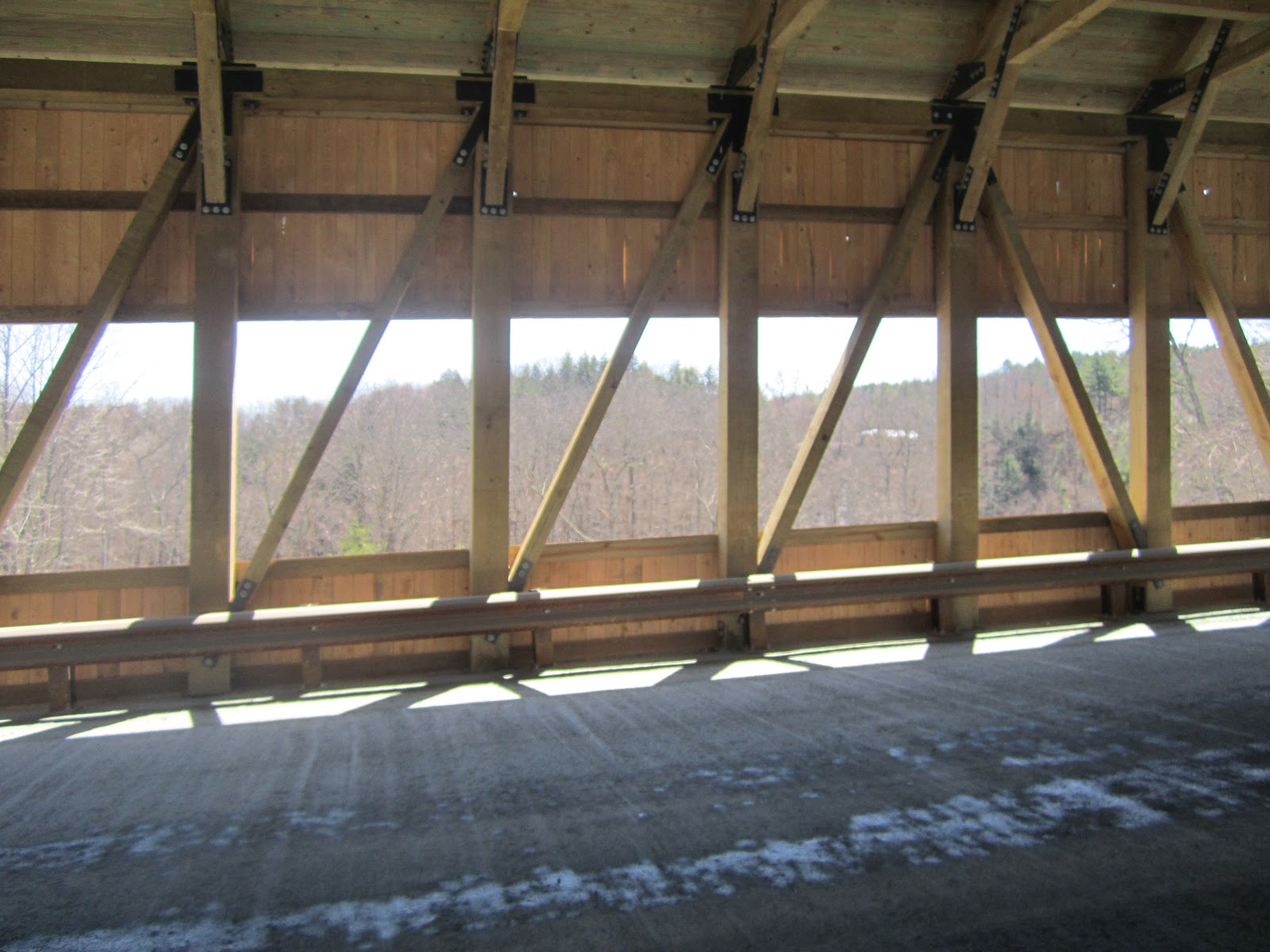
Today, we witnessed the birth of the new Taftsville Bridge.


It's not everyday you see a miracle!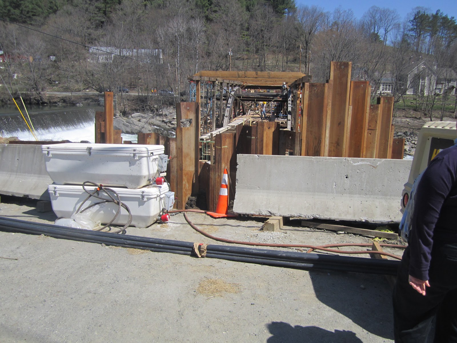


Today a bridge is being born!!!

The next bridge on the docket is the Lincoln!

Lincoln is so in right now!

This Lincoln stands tall, even without a stovepipe hat!

The bridge was built in 1877 with Pratt Trusses with Arches.

Woodstock is very good at labeling their bridges.

The bridge is that way...

I would love to visit the New York state monthly meetings. If only I could find the meetings...

The Middle!

Best warning sign on a bridge.

I love a bridge with a sidewalk sidecar!

Thanks again for the great labeling, Woodstock!

Such a beautiful day to enjoy a bridge!

Check out this lattice work.

The back side of the Middle.

The charming Woodstock Town Green.

What a great place to hide a bridge!

Lattice have more fun!

"Brief darkness leading from the light to light, ” Henry Wadsworth Longfellow.
The next bridge on our list was a privately bridge on a privately maintained road. We were not allowed to drive down the road.


So we followed the dirt road...

and continued to walk.

The Teago!

It is set along a beautiful, sweeping landscape.

If you look to the right of house, you can see how far away we had to park to walk. Ain't no mountain high enough to keep me away from Teago!

Killington is the second tallest peak in VT and in the Green Mountains.

However, Killington was not our next stop.

Our next stop, was the Pickle Barrel Night Club, home of the Pickle Barrel Bridge.

A night club with a bridge, is my kind of club!
Only in VT!

Well done, PBNC!

Sometimes on a road trip, you don't know what you are going to find. We looked to the left and saw a UCB (unidentified covered bridge)!

We looked for clues to find out more about the bridge. We found this gravestone for Maisey the Moose. Surprisingly, not much of a clue.

We were appreciating the beauty of the bridge, when we looked to the left and saw
 ]
]
a beautiful brook. We looked to the right and saw

a living zebra staring at us. Only in Vermont!

Next was the Bests Bridge.

A cute bridge, measuring only 37 feet, making it one of the shortest bridges in the state.

The Bowers Bridge spans the Mill Brook.

It was originally built in 1919. It was destroyed by Hurricane Irene in 2011.

The I Am Vermont Strong Project is working on Rebuilding, Reinvesting, and Revisiting.

Find out more about I Am Vermont Strong!
No comments:
Post a Comment